🌴 Tropical Meteorology & Equatorial Climatology
An exhaustive climatological dissertation on Earth’s tropical megathermal climate regimes (Group A). We analyze the thermodynamics of the equatorial convective trough, the atmospheric physics of flying rivers in the Amazon, dynamical land-sea thermal contrasts driving monsoon inversions, and savanna fire-vegetation ecological equilibrium states.
Encircling the planetary waistline between the Tropics of Cancer and Capricorn, Earth’s Tropical Climates represent the primary energetic powerhouse of the global climate machine. In these equatorial latitudes, incoming solar insolation is nearly constant throughout the calendar year: the solar zenith angle never deviates far from vertical, day length varies by barely an hour between seasons, and monthly mean temperatures remain perpetually above 18 degrees Celsius. The tropics absorb the lion’s share of planetary solar energy, converting oceanic water into trillions of tons of atmospheric moisture and driving the planetary Hadley circulation.
Yet, within this permanently warm tropical realm, precipitation dynamics diverge into three distinct climatological regimes: the continuously drenched Tropical Rainforests (Af), the seasonally violent Tropical Monsoons (Am), and the fire-adapted Tropical Savannas (Aw/As). Each regime is governed by a distinct fluid interaction between the Intertropical Convergence Zone (ITCZ), continental land-sea thermal contrasts, and regional orographic barriers.
In this comprehensive tropical climatology monograph, we dissect the thermodynamic convective engines of the equatorial trough, explore the biological physics of biotic moisture pumps, analyze cross-equatorial monsoon jet dynamics, and evaluate the bioclimatic stability of tropical savannas.
1. The Equatorial Radiative Engine: Convective Available Potential Energy (CAPE)
The defining physical engine of the equatorial rainforest climate (Af) is Deep Moist Convection. Operating within the low-pressure equatorial trough, tropical air columns are characterized by massive reservoirs of Convective Available Potential Energy (CAPE):
\text{CAPE} = \int_{z_{\text{LFC}}}^{z_{\text{EL}}} g \left( \frac{T_{v,\text{parcel}} – T_{v,\text{env}}}{T_{v,\text{env}}} \right) dz
Where $z_{\text{LFC}}$ is the Level of Free Convection, $z_{\text{EL}}$ is the Equilibrium Level (the tropical tropopause at 16 to 18 km), $g$ is gravity, and $T_v$ is virtual temperature. In equatorial zones, surface heating and intense ocean evaporation elevate surface dewpoints above 24°C to 26°C. Once morning solar heating lifts a humid air parcel past its LFC, virtual temperature remains significantly warmer than the surrounding environmental air column, generating CAPE values of 2,000 to 4,000 J/kg!
This buoyancy drives vertical updraft velocities of 15 to 30 m/s inside towering cumulonimbus clouds. Water vapor condenses, releasing 2.5 million Joules of latent heat per kilogram. This latent heat release fuels further buoyant acceleration, punching through the upper troposphere and spreading horizontally as massive anvil clouds (cumulonimbus incus) that generate daily afternoon convective downpours.
2. Amazonian Flying Rivers: The Biotic Moisture Pump Theory
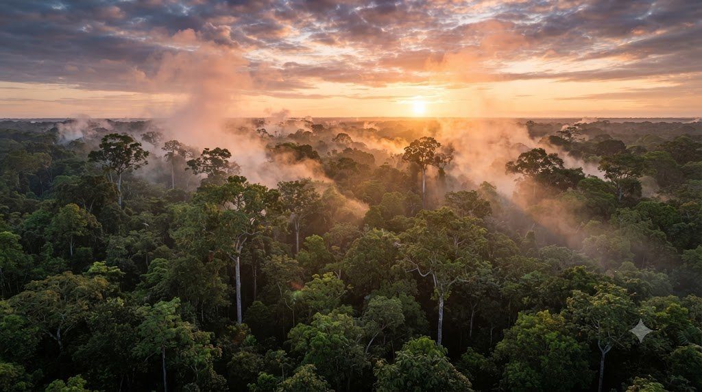
Conventional physical climatology historically assumed that continental rainfall declines exponentially as you move inland from the ocean, as atmospheric moisture is rained out. Yet, in the heart of the South American Amazon Basin—over 3,000 kilometers inland from the Atlantic Ocean—annual rainfall remains extraordinary: over 2,500 to 3,500 millimeters per year! How does the deep interior of a continent maintain rainforest conditions?
The answer is the Biotic Pump Hypothesis and the physics of Amazonian “Flying Rivers” (Rios Voadores), formulated by atmospheric physicists Anastassia Makarieva, Victor Gorshkov, and Antonio Nobre:
- Forest Evapotranspiration: An average mature Amazonian canopy tree possesses a massive root network and a leaf surface area many times its canopy footprint. Through transpiration, a single giant tree pumps over 1,000 liters of water into the atmosphere every day! Across the entire Amazon Basin containing roughly 390 billion trees, the forest pumps an astonishing 20 billion metric tons of water vapor into the air daily—a volumetric flow greater than the liquid discharge of the Amazon River into the Atlantic Ocean!
- Condensation-Induced Atmospheric Pressure Drop: When this massive volume of water vapor ascends and condenses into cloud droplets, gas volume contracts by roughly 1,200 times, generating an intense localized low-pressure vacuum. This thermodynamic suction pulls oceanic trade winds deep into the interior of the continent, perpetually refueling the atmospheric moisture pipeline!
- The Andean Moisture Wall: As these flying rivers travel westward across the continent, they collide with the towering 6,000-meter wall of the Andes Mountains. Deflected southward, this atmospheric river channels moisture across Bolivia, Paraguay, and southern Brazil, irrigating South America’s most productive agricultural zones!
3. Tropical Rainforest Climatology (Af): Biogeochemical Dynamics and Microclimates
The equatorial rainforest climate (Af) encompasses the Amazon Basin, the Congo Basin, and the Indonesian-Malaysian Archipelago. Its climatological hallmarks include:
- Thermal Uniformity: The annual range of monthly mean temperatures is typically less than 2.0°C to 3.0°C (e.g., Manaus, Brazil averages 26.5°C in January and 27.5°C in September). However, the diurnal temperature range is 8°C to 12°C: afternoon highs reach 32°C to 34°C, while nocturnal radiational cooling drops temperatures to 22°C to 24°C before dawn.
- Intense Vertical Canopy Stratification: Inside a dense tropical rainforest, the physical climate is vertically compartmentalized into five microclimatic strata:
- Emergent Layer (40 to 60 meters): Experiences blistering solar radiation, high wind speeds, and severe daytime vapor pressure deficits (VPD).
- Canopy Layer (25 to 40 meters): Absorbs over 85% of incoming photosynthetically active radiation (PAR).
- Understory (10 to 25 meters): Muted, diffused green light, high humidity, and suppressed wind.
- Shrub Layer (2 to 10 meters): Low light intensity (< 2% to 5% of surface sunlight).
- Forest Floor (0 to 2 meters): A stagnant, near-100% relative humidity greenhouse where wind speeds drop to < 0.1 m/s, accelerating fungal decomposition of leaf litter on highly leached, acidic Oxisol soils.
4. Tropical Monsoon Climatology (Am): Dynamical Land-Sea Thermal Inversion
The Tropical Monsoon climate (Am) represents one of the most dramatic seasonal meteorological reversals on Earth. Encountered across coastal India, Myanmar, Thailand, the Philippines, and parts of West Africa, it is driven by Giant Planetary Land-Sea Thermal Inversions:
1. The Winter Dry Monsoon (The Continental Regime): During Boreal Winter (December to February), the vast Asian continent cools rapidly under low solar insolation. A dense, cold anticyclone settles over Siberia. High barometric pressure over land pushes dry, cool, continental air from the northeast outward toward the warm Indian Ocean. Winds blow as the Northeast Monsoon: skies are cloudless, humidity plummets, and rainfall ceases for months, desiccating landscapes.
2. The Summer Wet Monsoon (The Oceanic Inversion): During Boreal Summer (June to September), solar insolation warms the massive landmass of South Asia and the high-elevation Tibetan Plateau (which acts as an elevated thermal radiator 4,500 meters above sea level). As hot air ascends over land, an intense thermal low-pressure trough develops (the Monsoon Trough). Simultaneously, the southern Indian Ocean remains cool, maintaining high barometric pressure.
The pressure gradient flips violently: the Southeast Trade Winds of the Southern Hemisphere surge across the equator. Upon crossing the equator, the Coriolis parameter changes sign ($f > 0$), deflecting the winds to their right and transforming them into the roaring Southwest Monsoon Jet (Findlater Jet)! Saturated with moisture evaporated over thousands of miles of tropical ocean, this jet slams into continental landmasses. Forced upward by the Western Ghats and the Himalayas, intense Orographic Precipitation unleashes catastrophic torrents: Cherrapunji, India, famously records average annual rainfall exceeding 11,700 millimeters (460 inches)!
5. Tropical Savanna Climatology (Aw/As): The Bimodal Wet-and-Dry Cycle
Flanking the equatorial rainforests to the north and south lies the Tropical Savanna Climate (Aw). The savanna is defined by an extreme, binary precipitation cycle: a sweltering, torrential wet summer followed by an arid, dusty, rainless winter.
This bimodal rhythm is governed by the seasonal latitudinal migration of global circulation belts:
- The High-Sun Wet Season: When the sun is overhead during summer, the low-pressure ITCZ migrates poleward, engulfing the savanna. Convective thunderstorms bring abundant rain (800 to 1,500 mm over 4 to 6 months). Rivers overflow, waterholes fill, and grasses surge to heights of 2 to 3 meters in an explosion of biological productivity.
- The Low-Sun Dry Season: When the sun migrates into the opposite hemisphere during winter, the ITCZ retreats equatorward. The descending branch of the Hadley cell—the Subtropical High-Pressure Ridge—settles directly over the savanna. For 5 to 7 months, sinking air prevents cloud formation. Humidity drops, smaller streams dry up, and the landscape enters severe meteorological drought.
- The Fire-Vegetation Ecological Equilibrium: Towards the end of the dry season, intense heat and bone-dry grass fuel catastrophic, continent-spanning landscape fires ignited by dry lightning. These recurring fires physically prevent broadleaf trees from establishing dense canopies, preserving the open, parkland landscape of fire-resistant trees (baobabs, acacias) set within continuous grassland carpets.
6. Comparative Climatological Profiles of Tropical Group A Climates
The following comparative matrix synthesizes the thermodynamic, precipitation, and ecological distinctions across the three tropical Group A climates:
| Climate Class | Köppen Code | Precipitation Seasonality | Annual Rainfall Range (mm) | Dominant Atmospheric Driver | Characteristic Natural Biome |
|---|---|---|---|---|---|
| Tropical Rainforest | Af | Perennially humid; all months >= 60 mm | 2,000 to 4,500+ mm | Equatorial convective trough; continuous ITCZ convergence | Multi-strata evergreen equatorial rainforest; extreme biodiversity |
| Tropical Monsoon | Am | Brief, severe dry season; massive wet summer surge | 1,500 to 3,500+ mm | Seasonal reversal of land-sea thermal gradient; Findlater jet | Dense semi-deciduous monsoon forest; teak and bamboo stands |
| Tropical Wet-and-Dry | Aw (Winter Dry) | Distinct 5-7 month rainless dry season; wet summer | 800 to 1,600 mm | Alternation between summer ITCZ and winter subtropical subsidence | Tall-grass savanna with scattered fire-adapted deciduous trees |
| Tropical Dry-Summer | As (Summer Dry) | Rare inverted cycle; dry summer, wet winter | 700 to 1,400 mm | Local orographic rain-shadow during summer monsoon | Drought-deciduous woodland; coastal scrub (e.g., eastern Sri Lanka) |
7. Tropical Cyclogenesis: Ocean Thermal Energy and Atmospheric Shear
While the equatorial ITCZ generates ordinary thunderstorms, tropical oceans between 5° and 20° latitude north and south spawn the most ferocious, destructive weather systems on Earth: Tropical Cyclones (Hurricanes and Typhoons).
A tropical cyclone is a self-sustaining thermodynamic Carnot heat engine fueled by the release of latent heat from seawater. Cyclogenesis requires the simultaneous convergence of six strict atmospheric and oceanic prerequisites formulated by William Gray:
- Warm Ocean Sea Surface Temperature (SST $\ge 26.5^\circ ext{C}$): Ocean surface water must be at least 26.5°C extending down to a depth of at least 50 meters (high Ocean Heat Content / OHC). Sinking below this threshold cuts off the thermal steam pipeline feeding the storm.
- High Atmospheric Instability and Mid-Tropospheric Moisture: Relative humidity in the middle troposphere (700 hPa to 500 hPa) must exceed 50% to 60%. Dry air entrainment rapidly evaporates cloud droplets, generating cold downdrafts that choke off the central updraft.
- Significant Coriolis Deflection ($f > 0$): Tropical cyclones cannot form within 5 degrees of the Equator because the Coriolis parameter ($f = 2\Omega \sin \phi$) is near-zero! Without Coriolis force, incoming winds blow directly into the central low pressure, immediately filling the pressure void before rotational cyclonic spin can develop.
- Low Vertical Wind Shear ($\Delta v_{ ext{vertical}} < 10 ext{ m/s}$): The difference in wind speed and direction between the surface and the upper troposphere (200 hPa) must be very weak (< 10 m/s or 20 knots). Strong vertical shear physically tilts the storm's convective chimney, ventilating heat away from the core and tearing the cyclone apart.
- Pre-Existing Low-Level Vorticity: An initial disturbance—such as an African Easterly Wave rolling off the coast of Senegal—is required to provide the initial cyclonic spin.
8. The Tropical Soil Paradox: Oxisols, Laterites, and Nutrient Leaching
The astonishing biological productivity of tropical rainforests conceals an extraordinary pedological contradiction: The Tropical Soil Paradox.
Travelers gazing upon towering 50-meter-tall rainforest canopies often assume that the underlying soil must be exceptionally rich in minerals. In reality, the soils beneath ancient tropical rainforests—predominantly Oxisols (Ferralsols) and Ultisols—are among the most sterile, nutrient-depleted, and chemically exhausted soils on planet Earth!
- Centuries of Extreme Leaching: Because equatorial landmasses were never scraped clean by Pleistocene glaciers, tropical soils have weathered continuously under heavy warm rainfall for millions of years. Soluble basic nutrients (calcium, magnesium, potassium) and silica have been completely leached out of the profile.
- Aluminum and Iron Oxide Accumulation (Laterization): Leaching leaves behind only highly insoluble, weather-resistant sesquioxides of iron and aluminum (hematite, goethite, gibbsite). This gives tropical subsoils their characteristic rusty brick-red color. When deforested and baked by the tropical sun, some high-iron Oxisols irreversibly harden into stone-like Laterite crusts upon which plants can no longer root.
- Closed Biological Nutrient Loop: Over 95% of the total nutrient inventory in a tropical rainforest is stored not in the mineral soil, but in the living biomass of the forest itself! When leaves and branches drop, hyper-active termites, ants, and mycorrhizal fungi recycle nutrients back into living roots within days. If the forest is cleared for conventional cattle ranching or monoculture farming, this closed biological loop is destroyed; soil fertility collapses within 2 to 3 years.
9. Deforestation and the Amazon Rainforest Dieback Tipping Point
In modern Earth System Science, the Amazon Basin is identified as a critical planetary tipping element vulnerable to an abrupt, irreversible transition known as The Amazon Dieback (Savannization).
Pioneering climatological modeling by Carlos Nobre and Thomas Lovejoy demonstrates that the Amazon rainforest creates its own rainfall through the biotic pump mechanism. If deforestation—combined with anthropogenic climate warming—exceeds a critical threshold of 20% to 25% total forest clearing, the regional hydrological cycle will cross a point of no return:
- Clearing forest reduces regional evapotranspiration, weakening the low-pressure suction that draws Atlantic trade winds inland.
- The dry season lengthens by 2 to 4 weeks, and annual rainfall drops across the basin by 15% to 25%.
- Moisture stress triggers widespread mortality among tall, broadleaf evergreen canopy trees.
- Drying fuels unprecedented mega-fires, permanently transforming up to 50% to 60% of the dense Amazon rainforest into a degraded, fire-prone, low-biomass savanna!
- This collapse would release an estimated 100 to 150 billion metric tons of stored carbon into the atmosphere, accelerating global warming and disrupting rainfall patterns across the entire Western Hemisphere.
10. Remote Sensing of Tropical Systems: TRMM, GPM, and Synthetic Aperture Radar
Tracking cloud physics, precipitation rates, and biomass structure across thousands of kilometers of inaccessible tropical jungles requires specialized satellite earth observation missions:
- The Tropical Rainfall Measuring Mission (TRMM) and GPM: NASA and JAXA launched TRMM (1997–2015) and its successor, the Global Precipitation Measurement (GPM) Core Observatory (2014–present). Carrying the first spaceborne Dual-Frequency Precipitation Radar (DPR) operating at Ku-band (13.6 GHz) and Ka-band (35.5 GHz), GPM slices through tropical storm clouds to construct 3D profiles of raindrop and ice particle size distributions, quantifying rainfall rates with unmatched precision.
- Spaceborne Synthetic Aperture Radar (L-Band SAR): Optical satellites cannot see through continuous tropical cloud cover. Earth-observing satellites like ALOS-2 and the upcoming NASA-ISRO SAR (NISAR) deploy long-wavelength L-band radar (24 cm wavelength). L-band radar waves penetrate cloud cover, rainforest canopies, and foliage, bouncing off tree trunks and the ground to measure forest above-ground biomass, swamp inundation, and illegal deforestation in near-real-time.