❄️ Cryospheric Physics & Glacial Geophysical Dynamics
An exhaustive geophysical dissertation on Earth’s cryospheric climate system. We derive the surface energy balance of snow and ice, quantify the non-linear ice-albedo positive feedback loop, examine ice sheet dynamics and marine ice cliff instability (MICI), analyze permafrost methane clathrate kinetics, and calculate glacial isostatic adjustment (GIA) crustal rebound physics.
The Cryosphere—comprising all frozen water across planet Earth in the form of continental ice sheets, mountain glaciers, seasonal snow cover, sea ice, lake ice, and subterranean permafrost—is the most thermally sensitive and dynamic component of the planetary climate system. Covering more than 10% of global land area and up to 15% of the world ocean during seasonal maximums, the cryosphere contains over 24 million cubic kilometers of freshwater ice. If fully melted, this colossal frozen reservoir holds enough water to raise global mean sea levels by an astonishing 66 meters (216 feet)!
Yet, the cryosphere’s role in global climate extends far beyond serving as a static freshwater storage tank. The cryosphere is a primary thermodynamic regulator of Earth’s surface energy budget. By virtue of its brilliant white reflectivity, snow and ice reflect incoming solar radiation straight back into space, shielding the planet from solar heating. Furthermore, ice possesses immense latent heat of fusion ($L_f \approx 334\text{ kJ/kg}$), acting as an enormous thermal buffer that absorbs staggering amounts of heat without changing temperature during phase transitions.
In this comprehensive geophysical monograph, we dissect the mechanics of ice sheet mass balance, parameterize the non-linear physics of the ice-albedo feedback, evaluate marine ice sheet and ice cliff instabilities in West Antarctica, and analyze permafrost carbon release kinetics.
1. The Surface Energy Balance of Snow and Ice: High-Albedo Optics
The thermodynamic state of any snow or ice surface is determined by the net Surface Energy Balance (SEB) equation:
Q_{\text{net}} = S_{\downarrow}(1 – \alpha) + L_{\downarrow} – L_{\uparrow} + Q_H + Q_E + Q_G + Q_M
Where:
- $S_{\downarrow}$ is incoming shortwave solar radiation and $\alpha$ is the surface albedo.
- $L_{\downarrow}$ and $L_{\uparrow}$ are incoming atmospheric and outgoing surface longwave infrared radiation.
- $Q_H$ is sensible turbulent heat flux and $Q_E$ is latent turbulent heat flux (sublimation/evaporation).
- $Q_G$ is conductive heat flux through the ice column.
- $Q_M$ is energy available for melt (positive only when surface temperature reaches $0^\circ\text{C}$).
The Radiative Dominance of Albedo ($\alpha$): Pure, freshly fallen dry snow is the most reflective natural substance on Earth, boasting a shortwave albedo between 0.80 and 0.90. It reflects up to 90% of incoming solar energy straight back into space! However, as snow ages, metamorphoses, and melts, optical physics shift dramatically:
- Grain Size Metamorphism: Warmer temperatures cause fine snow crystals to round and sinter into larger, coarser grains. Larger grains have longer optical mean free paths, allowing photons to penetrate deeper into the snowpack before scattering, dropping albedo to 0.60 to 0.70.
- Surface Melt Ponds and Bare Ice: When snow melts to expose bare glacial ice, albedo plummets to 0.40 to 0.55. On Arctic sea ice, meltwater pools into dark turquoise melt ponds with an albedo of barely 0.15 to 0.25!
- Open Ocean Contrast: Open seawater has an albedo of barely 0.06 to 0.08—absorbing over 92% of all incoming solar radiation!
2. The Non-Linear Ice-Albedo Positive Feedback Loop
The stark optical contrast between reflective ice ($\alpha \approx 0.85$) and absorbing seawater ($\alpha \approx 0.06$) gives rise to the classic Ice-Albedo Positive Feedback Mechanism, the primary driver of Arctic Amplification:
- An initial radiative perturbation (such as elevated greenhouse gases) warms the high-latitude atmosphere.
- Warmer surface temperatures melt snow and cause earlier seasonal retreat of Arctic sea ice.
- The retreat of white sea ice exposes vast expanses of dark, open ocean waters.
- The dark open ocean absorbs over 90% of incoming solar radiation throughout the long 24-hour Arctic summer daylight, storing immense heat in the upper oceanic mixed layer.
- This stored oceanic heat delays autumn freeze-up, thins newly formed winter ice, and radiates heat upward, driving further atmospheric warming!
Because of this powerful positive feedback loop, the Arctic has warmed at a rate three to four times faster than the global planetary average over the satellite observation era (1979–present), causing multi-year Arctic sea ice volume to collapse by over 70%!
3. Continental Ice Sheet Mass Balance: Accumulation vs. Ablation
Earth’s two great continental ice sheets—the Greenland Ice Sheet (holding 7.4 meters of sea level equivalent) and the Antarctic Ice Sheet (holding 58.3 meters of sea level equivalent)—maintain their volume through the balance between mass gain and mass loss, known as Total Mass Balance (TMB):
\text{TMB} = \text{SMB} – D = (\text{Accumulation} – \text{Runoff} – \text{Sublimation}) – D
Where $\text{SMB}$ is the Surface Mass Balance and $D$ is Dynamic Ice Discharge (iceberg calving and sub-shelf ocean melting at grounding lines):
- The Accumulation Zone: Across high-elevation interior plateaus (summit of Greenland at 3,200 m, East Antarctic Plateau at 4,000 m), temperatures never rise above freezing. Mass is added strictly through snowfall accumulation ($P$). Snow is compressed under the weight of subsequent layers, transforming into coarse granular Firn and eventually recrystallizing into dense, impermeable glacial ice at a density of $\\rho \approx 917\text{ kg/m}^3$.
- The Ablation Zone: At lower elevations near ice sheet margins, summer temperatures exceed 0°C. Mass is lost through surface meltwater runoff into supraglacial rivers and moulins, and through direct sublimation into dry polar air.
- The Equilibrium Line Altitude (ELA): The exact elevation boundary where annual accumulation precisely equals annual ablation. When regional temperatures warm, the ELA shifts higher up the mountain or ice sheet, converting former accumulation zones into net ablation zones.
4. Ice Sheet Dynamic Flow: Glen’s Flow Law and Basal Sliding Physics
Glacial ice is not a rigid static solid; under the crushing weight of kilometers of overburden pressure, ice behaves as a non-Newtonian viscoplastic fluid that deforms and flows downhill toward the sea. Glacial ice deformation is governed by Glen’s Flow Law:
\dot{\varepsilon} = A \tau^n
Where $\dot{\varepsilon}$ is strain rate (rate of internal ice deformation), $\tau$ is basal shear stress, $n \approx 3$ is the non-linear rheological exponent, and $A$ is a rate factor that depends exponentially on ice temperature via the Arrhenius relation. Because $n = 3$, doubling the gravitational driving stress on an ice stream increases its flow rate by an astonishing eight times ($2^3 = 8$)!
Basal Lubrication and Subglacial Hydrology:
Ice does not move solely through internal creep deformation; the fastest ice streams (e.g., Jakobshavn Isbræ in Greenland flowing at over 15 kilometers per year!) move primarily via Basal Sliding. When surface meltwater plunges down vertical ice shafts called Moulins, it reaches the subglacial bedrock. Water pressure elevates subglacial pore pressure, partially floating the ice sheet off its rock bed. Friction collapses, and the colossal ice stream slides into the sea at high speed!
5. Marine Ice Sheet Instability (MISI) and Marine Ice Cliff Instability (MICI)
The single greatest wildcard in 21st-century sea level rise projections is the catastrophic instability of marine-grounded ice sheets—specifically the West Antarctic Ice Sheet (WAIS).
Unlike East Antarctica, which sits on land above sea level, the West Antarctic Ice Sheet rests on a continental bed that lies up to 2,000 meters below sea level. Crucially, the bedrock exhibits a Retrograde Bed Slope—meaning the bedrock slopes downward toward the interior of the continent as you move inland from the coast!
This retrograde geometry triggers two terrifying, irreversible physical collapse mechanisms:
- Marine Ice Sheet Instability (MISI): The ice sheet flows into the ocean, terminating in floating Ice Shelves (e.g., Pine Island and Thwaites ice shelves). The line where the ice lifts off bedrock is the Grounding Line. According to Schoof’s grounding line flux theory, ice discharge flux across the grounding line scales non-linearly with ice thickness: $q \propto h^4$. Because warm deep circumpolar ocean water is melting floating ice shelves from below, grounding lines are retreating backward down the retrograde slope into deeper water. In deeper water, ice thickness ($h$) is naturally greater, which mechanically forces ice flux ($q$) to accelerate! This creates a self-sustaining, runaway collapse that cannot be stopped even if atmospheric warming ceases!
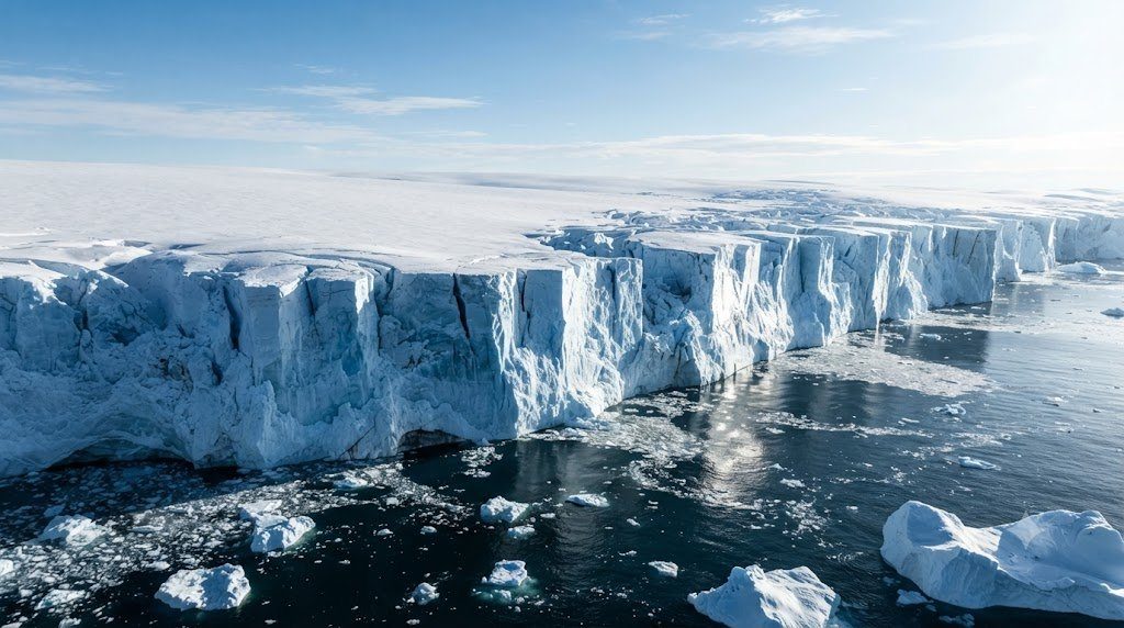
- Marine Ice Cliff Instability (MICI): Glacial ice has a finite shear structural strength (approximately 1 MPa). If warm ocean waters completely melt away the protective floating ice shelf, it leaves behind an exposed, vertical ice cliff towering out of the sea. Structural engineering physics dictates that a pure ice cliff taller than 90 to 100 meters above sea level cannot support its own weight! The ice cliff undergoes catastrophic structural shear failure, calving into the sea in continuous structural avalanches and exposing an even taller cliff behind it, driving rapid ice sheet collapse.
6. Permafrost Thermodynamics and Methane Clathrate Degradation
Covering nearly 24% of the exposed land area of the Northern Hemisphere, Permafrost is defined as ground (soil, sediment, or rock) that remains at or below 0°C for at least two consecutive years. Permafrost consists of a seasonal surface Active Layer (which thaws in summer and refreezes in winter) underlain by deep, permanently frozen ground reaching depths up to 1,500 meters in Siberia.
The permafrost zone contains an immense, hazardous planetary carbon reservoir:
- The Permafrost Carbon Bomb (~1,500 Billion Tons of Organic Carbon): Frozen permafrost soils preserve vast quantities of undecomposed Pleistocene plant and animal remains. This reservoir holds roughly double the total carbon currently present in the entire Earth’s atmosphere!
- Microbial Mineralization Cascades: As atmospheric warming deepens the summer active layer and triggers thermokarst permafrost thaw, dormant soil microbes awaken. In dry, well-aerated aerobic thaw zones, microbes oxidize organic carbon into carbon dioxide ($CO_2$). In saturated, anaerobic thermokarst lakes and bogs, methanogenic archaea decompose organic matter into Methane ($CH_4$), which bubbles furiously to the surface. Methane has a 28-to-36 times greater global warming potential than $CO_2$ over a 100-year timescale.
- Sub-Sea Methane Hydrates (Clathrates): Along the shallow Siberian Arctic continental shelf, immense quantities of methane gas are trapped in crystalline water-ice cages termed Methane Clathrates under high hydrostatic pressure and cryogenic temperatures. Warming ocean bottom waters threaten to destabilize these crystalline lattices, potentially releasing plumes of methane gas directly into Arctic waters.
7. Glacial Isostatic Adjustment (GIA) and Crustal Geophysics
When continental ice sheets grow or melt, they exert immense mechanical forces on the Earth’s solid lithosphere and viscous mantle, a geophysical phenomenon termed Glacial Isostatic Adjustment (GIA):
The Earth’s crust (lithosphere) floats atop the semi-fluid, highly viscous asthenosphere mantle. During the Last Glacial Maximum (20,000 years ago), the 3-kilometer-thick Laurentide and Fennoscandian ice sheets weighed trillions of tons, depressing the continental crust downward by over 500 to 800 meters while squeezing viscous mantle rock outward into peripheral “forebulges.”
Following the deglaciation of these massive ice sheets, the crust began rebounding back toward equilibrium:
- Post-Glacial Rebound: Regions formerly buried under ice (such as Hudson Bay in Canada and the Gulf of Bothnia in Sweden) are currently rising vertically at rates of 1.0 to 1.5 centimeters per year as the viscous mantle flows back beneath the continents. Relative sea level in these harbors is actually falling!
- Forebulge Collapse: Concurrently, regions situated along the perimeter of the former ice sheets (e.g., the U.S. Mid-Atlantic coast, Chesapeake Bay, and southern England) were propped up on the ancient forebulge. Today, that forebulge is actively subsiding and sinking back into the mantle, amplifying localized relative sea level rise along cities like Norfolk and Baltimore by an additional 1 to 2 mm per year!
- Gravitational Fingerprinting: Massive ice sheets exert immense gravitational attraction on surrounding ocean water, pulling seawater toward their coasts. When the Greenland Ice Sheet melts and loses mass, its gravitational pull weakens: sea levels actually drop within 2,000 km of Greenland, while surging with amplified magnitude across the distant Southern Hemisphere!
8. Comparative Physical Inventory of Earth’s Major Cryospheric Reservoirs
The following geophysical matrix synthesizes the physical scale, volume, and sea level equivalent potential of Earth’s major frozen components:
| Cryospheric Reservoir | Geographic Extent | Ice Volume (km³) | Sea Level Equivalent (m) | Primary Melt Vulnerability Mechanism |
|---|---|---|---|---|
| East Antarctic Ice Sheet (EAIS) | Continental East Antarctica | 25,000,000 km³ | 52.8 meters | Sub-ice shelf ocean melting; marine basins (Wilkes, Aurora); high stability plateau |
| West Antarctic Ice Sheet (WAIS) | Marine-grounded West Antarctica | 2,200,000 km³ | 5.3 meters | Retrograde bed slope; MISI and MICI collapse at Thwaites and Pine Island glaciers |
| Greenland Ice Sheet (GIS) | Greenland Continental Landmass | 2,900,000 km³ | 7.4 meters | Surface melt amplification; albedo darkening; ELA elevation; coastal outlet calving |
| Global Mountain Glaciers | Himalayas, Andes, Alps, Alaska | 170,000 km³ | 0.42 meters (42 cm) | Direct thermal ablation; hypsometric elevation; debris-covered melt mechanics |
| Arctic Sea Ice (Multi-Year) | Arctic Ocean Basin | 15,000 to 25,000 km³ | 0.0 meters (Floating ice) | Ice-albedo positive feedback; basal ocean warming; multi-year ice loss |
| Permafrost Carbon Reservoir | Siberia, Canada, Alaska, Tibet | 1,500 Gt Carbon | N/A (Greenhouse Forcing) | Thermokarst lake collapse; active layer deepening; microbial methanogenesis |
9. Cryospheric Tipping Points and Abrupt Planetary Reorganization
In modern Earth System Science, components of the cryosphere are classified as primary Planetary Tipping Elements—systems that can undergo abrupt, irreversible transitions once a critical global warming threshold is crossed.
Paleoclimatological and numerical modeling indicates three interconnected cryospheric tipping thresholds:
- Greenland Ice Sheet Melt Threshold (~1.5°C to 2.0°C Global Warming): As the Greenland Ice Sheet melts, its surface elevation drops. Because the atmosphere warms with decreasing altitude according to the atmospheric lapse rate (~6.5°C per kilometer), lowering the surface of the ice sheet pushes the ice into permanently warmer air layers—the Elevation-Surface Mass Balance Feedback. Once the ice surface drops below a critical threshold, total deglaciation becomes irreversible across millennial timescales.
- Thwaites Glacier / WAIS Marine Collapse (~1.5°C to 2.5°C Warming): Thwaites Glacier is termed the “Doomsday Glacier” because it acts as the keystone cork holding back the interior West Antarctic ice basin. Once its grounding line retreats past the marine pinning ridge, collapse of the entire marine-grounded basin becomes inevitable.
- Summer Arctic Sea Ice Disappearance (~1.5°C to 2.0°C Warming): The transition to a seasonally ice-free Arctic Ocean in September will permanently eliminate high-latitude albedo buffering, fundamentally altering northern hemispheric Rossby wave dynamics.
10. Remote Sensing Cryosphere Monitoring: Laser Altimetry and Gravimetry
To quantify high-latitude ice mass changes across millions of square kilometers of inaccessible frozen wilderness, modern glaciology relies on advanced satellite remote sensing technologies:
- GRACE and GRACE-FO Satellite Gravimetry: The Gravity Recovery and Climate Experiment (GRACE) deployed twin satellites tracking micro-meter variations in the distance between each other using K-band microwave and laser ranging. As the satellites fly over Greenland or Antarctica, gravitational anomalies caused by regional ice mass loss pull the lead satellite forward. GRACE measures absolute mass loss directly, confirming that Greenland is shedding an average of 270 billion metric tons of ice annually, while Antarctica is losing over 150 billion metric tons per year.
- ICESat-2 Laser Altimetry: NASA’s Ice, Cloud, and land Elevation Satellite-2 (ICESat-2) fires a high-rate green laser (532 nm) splitting into six beams, pulsing 10,000 times per second. By timing individual photon round-trips with picosecond precision, ICESat-2 maps the vertical elevation of ice sheets and sea ice freeboard with sub-centimeter vertical accuracy, capturing the rapid thinning of coastal outlet glaciers.
- CryoSat-2 Synthetic Aperture Radar (SAR): The European Space Agency’s CryoSat-2 deploys a dual-antenna radar interferometer (SIRAL) that penetrates cloud cover and polar winter darkness, continuously charting sea ice thickness and continental ice shelf thinning rates across both poles.